Summary
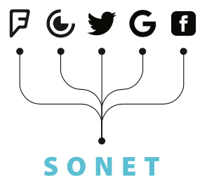 SONET is a comprehensive semantic knowledge graph that is originally created to support the conflation of heterogenous geographic feature categories from diverse data sources in the PlanetSense project. SONET currently includes over 16,000 geographic feature categories with 113,020 knowledge links among them. It provides semantic interlinks through OpenStreetMap tags for over ten popular spatial data sources on the web that includes GEM Taxonomy, NAICS, among others. SONET is created by integrating ontology engineering, natural language processing, machine learning and semantic web technology, and it serves as a foundational information infrastructure for handling geographic data heterogeneity in various research and applications, including human dynamic modeling, locational intelligence, and temporally adaptive multi-scale global land use modeling.
Objectives
- Support the conflation of heterogenous geographic feature categories from diverse spatial data sources
- Foundational spatial information infrastructure that links diverse spatial data sources on the web
- Provide a unified tagging schema for geographic feature categories from different data sources
- Link different spatial data schemas through a shared semantic tagging schema
- Seamless integration of heterogeneous spatial data with Web 3.0 linked open data cloud
Features

Semantic bridge for heterogeneous geographic data schemas

Semantic translation between geographic feature categories and OSM tags

OSM tags as semantic bridge for heterogeneous geographic feature categories

Multiple semantic granularities based on hierarchical organization of geographic feature categories

Formal ontological model to support link of SONET with other Linked Open Data
Scientific artifacts
| Year | Citation |
|---|---|
| 2020 | Thakur, G., Sparks, K., Berres, A., Tansakul, V., Chinthavali, S., Whitehead, M., Schmidt, E., Xu, H., Fan, J., Spears, D., & Cranfill, E. (2020). COVID-19 Joint Pandemic Modeling and Analysis Platform. Proceedings of the 1st ACM SIGSPATIAL International Workshop on Modeling and Understanding the Spread of COVID-19, COVID-19 2020, 43–52. https://doi.org/10.1145/3423459.3430760 |
| 2019 | Palumbo, R., Thompson, L., & Thakur, G. (2019). SONET: A Semantic Ontological Network Graph for Managing Points of Interest Data Heterogeneity. Proceedings of the 3rd ACM SIGSPATIAL International Workshop on Geospatial Humanities - GeoHumanities ’19. https://doi.org/10.1145/3356991.3365474 |
| 2023 | Fan, J. , Bentley, J. & Thakur, G. (2023). SONET++: A Knowledge Graph of Geographic Categories based on OSM Tag Representation. GIScience Conference 2023. |
Contact Us
Junchuan Fan
Location Intelligence Group
Human Dynamics Section,
Geospatial Science and Human Security Division
National Security and Sciences Directorate
Oak Ridge National Laboratory
Gautam Thakur
Location Intelligence Group
Human Dynamics Section,
Geospatial Science and Human Security Division
National Security and Sciences Directorate
Oak Ridge National Laboratory
